

Putnam Township Looks To Establish "Green Infrastructure"
July 13, 2017
Putnam Township is working towards developing a plan to preserve its natural resources and areas, while still keeping room open for development.
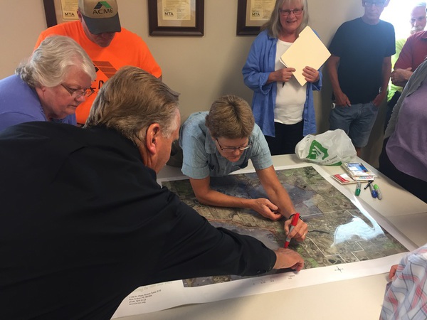
On Wednesday, the township’s planning commission met with the Huron River Watershed Council’s Kris Olsson, a Watershed Ecologist. Olsson is guiding the township in their effort to create a Green Infrastructure Vision.
The process begins by labeling large and smaller natural areas on a map of the township, then connecting them with existing waterways and other natural areas to form a network. The interconnected network helps support native species, ecological processes, and water and air resources.
The map outlining the Green Infrastructure can be adopted and/or added to the municipality’s master plan. Olsson says this map helps the township’s leaders determine what areas should be preserved for natural purposes, and which areas can allow for future development.
About 10 residents offered their input at Wednesday’s workshop, contributing to the discussion among commissioners and Olsson. Olsson intends to present a map and draft of the Green Infrastructure plan at the planning commission’s next meeting. Commissioners can then decide if there’s anything they’d like to change, further include, and what their next steps are in implementing the plan. (DK)